


Region of the CCCN pilot model: South-West Moravia (SW Moravia)
Geographic characteristics
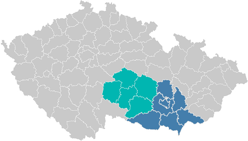
Position of the target area of the CCCN pilot model in the Czech Republic: the Vysočina Region (green) and the South Moravian Region (blue) = SW Moravia
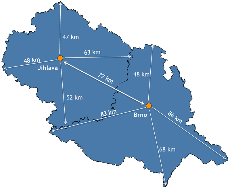
Distances in the target area of the CCCN pilot model (SW Moravia)
Together, the South Moravian Region and the Vysočina Region (= SW Moravia) account for 18% of the total area of the Czech Republic. Although these two regions are geographically next to each other, their remote parts are very different.
The Bohemian-Moravian Highlands covers the northern and north-western part of the South Moravian region as well as the entire Vysočina Region (hence its Czech name, which translates as the “Highlands Region”). This is in sharp contrast to the southern part of the South Moravian Region, which is predominately flat and covered by fields, meadows, and the remainders of riparian forests.
Accessibility and catchment area
Brno and Jihlava are administrative centres of the South Moravian Region and the Vysočina Region, respectively. However, transport accessibility is much lower in Jihlava than in Brno. Brno has been a natural catchment area of the entire South Moravian Region for decades, whereas Jihlava was declared administrative centre of the Vysočina Region only in 2000, upon the official establishment of this region.
Both regions are served by a network of motorways and roads. The Vysočina Region is intersected by the D1 motorway, which is the main road connection between Prague and Brno – the two largest cities of the Czech Republic. Transportation within both regions is based on a dense network of minor roads (used for both public and individual transport) and a railway network. Railway transport, however, is rather limited in the Vysočina Region due to its hilly landscape. In contrast, Brno is transport hub of the South Moravian Region, enjoying a strategic position on the intersection of national rail routes. Local trains in the South Moravian Region serve many towns and villages.
The D1 motorway enables quick transport between the two regional capitals – Jihlava and Brno. The travel distance is approximately 90 km. Around 20 bus connections operate daily in both directions with an approximate duration of 70–90 min; travelling by car takes about 1 hour. All cancer centres are easily accessible via the main connection roads and the public transport.
Read more about:
Summary of characteristics of the target area of the CCCN pilot model
| CCCN part: South Moravian Region | CCCN part: Vysočina Region | SW Moravia | |
|---|---|---|---|
| Population (as of 1/1/2016) | 1 175 025 | 509 475 | 1 684 500 |
| Area (km2) | 7 195 | 6 796 | 13 991 |
| Population density (per km2) | 163 | 75 | 120 |
| Number of districts | 7 | 5 | 12 |
| Number of municipalities | 673 | 704 | 1 377 |
| Total length of roads and motorways (km, estimation) | 4500 | 5000 | 9500 |
| Total length of railway network (km, estimation) | 800 | 650 | 1450 |
Sources: Czech Statistical Office, web portals of the Vysočina Region and the South Moravian Region